Graphic Image or Map of Bioregion:
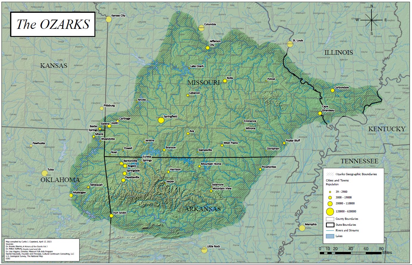
(Click to expand map)
- Website: Ozark Area Community Congress
- Contact: Sasha Daucus
- Email: oaccleaf@gmail.com
- Mailing Address:
OACC c/o Sasha Daucus
1510 Ripley Route EE
Doniphan, MO 63935 - Social Media:
–Facebook
Focus:
Ozark Area Community Congress (OACC) (pronounced oak) is an ecological network and forum for participants who meet annually to share ideas and information. Every year since 1980, a group of ecology-minded folks has gathered to discuss, celebrate, and learn about all things Ozark. OACC was the first bioregional congress ever established, and it inspired the formation of other such congresses. In 1984, OACC participants played a big role in the convening of the first continental bioregional congress.
Bioregion Description:
The forested, stream-dissected hills of southern Missouri and northern Arkansas form a distinct bioregion known as the Ozarks. Clearly different from surrounding areas in topography, watershed characteristics, plant distribution and wildlife populations, the natural qualities of this area have affected the development of human culture within it. The southeast boundary of the Ozark Bioregion lies distinctly where the mountains end abruptly as they abut the alluvial plain of the Mississippi River. The western boundary of the Ozarks is more diffuse, where the prairies intermingle with, and gradually give way to the forested hills of the Ozark Bioregion. The northern boundary roughly follows the Missouri River, but may be more accurately thought of as the most southern reaches of the glaciers in the last ice age that flattened the terrain north of the Ozarks. The eastern boundary follows the Mississippi River from near the confluence of the Missouri River south to the Mississippi alluvial plain. An exception is that the hilly terrain across the Mississippi (in the far southern tip of what is politically defined as Illinois) that is sometimes thought of as part of the Ozark Bioregion. The southern boundary of the Ozark Bioregion might be the Arkansas River, or it might be the southern extent of the Ouachita Mountains. It depends who you ask.
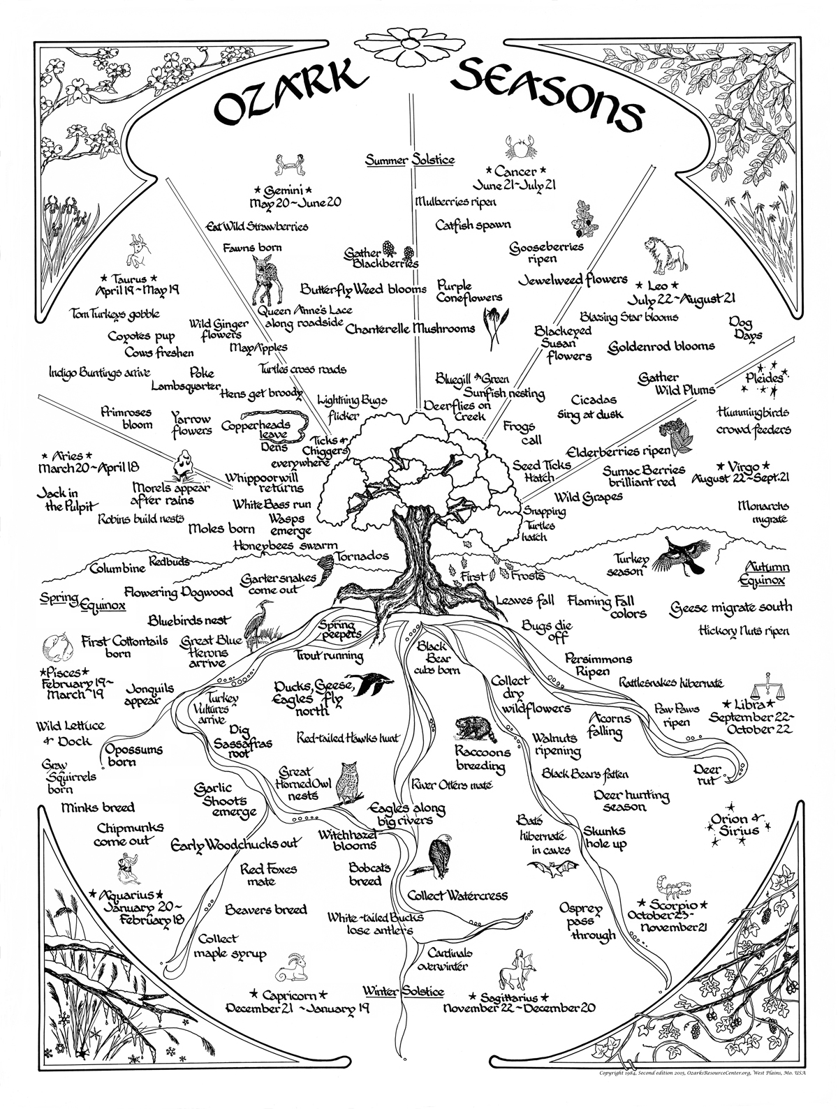
Bioregional Drawings, Photos, Poems, Music, Recipes: