Graphic Image or Map of Bioregion:
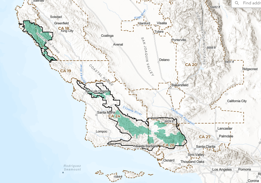
(Click to expand map)
- Website: Los Padres ForestWatch
- Contact: Keri Setnika
- Email: info@forestwatch.org
- Social Media Links:
–Facebook
–Instagram
–LinkedIn
–Bluesky
–Youtube
Focus:
Los Padres ForestWatch protects wildlife, wilderness, water, and sustainable access throughout Los Padres National Forest and Carrizo Plain National Monument. We achieve this through education, advocacy, and when necessary, legal action for the benefit of our communities, climate, and future generations.
Bioregion Description:
Los Padres National Forest stretches nearly 220 miles along California’s Central Coast, spanning 1.75 million acres across Ventura, Santa Barbara, San Luis Obispo, Monterey, and Kern counties. Part of the broader California Central Coast bioregion, the region includes diverse ecosystems ranging from chaparral and oak woodlands to coastal sage scrub, grasslands, riparian corridors, conifer forests, and rugged coastline. Its mountains and wildlands feed vital watersheds including the Ventura River, Sespe Creek, Santa Ynez River, Sisquoc River, Piru Creek, and Salinas River headwaters, sustaining wildlife, communities, and the Pacific Ocean beyond. These lands have been stewarded since time immemorial by Indigenous peoples including the Chumash, Tataviam, Salinan, Esselen, Yokuts, and Kitanemuk peoples, whose enduring relationships with the land continue to shape the ecological and cultural identity of the region today.
Video URL: